Monday, 6 February 2012

Horseshoe Falls - Tasmania

The Horseshoe Falls are situated in the Mount Field National Park, 100 meters upstream of Russell Falls, approximately 70 kilometers northwest of Hobart via the Brooker Highway to New Norfolk.


To visit Horseshoe Falls from Russell Falls you can make your way up a steep, but short climb.
Though much smaller in size to Russell Falls, Horseshoe Falls perhaps overwhelms it in terms of beauty, becoming perhaps even more photographed and recognized part of the Mount Field National Park.


Horseshoe falls, Tasmania


Horseshoe falls, Tasmania


Approximate coordinates: -42.682238,146.71679

Russell Falls - Tasmania

The Russell Falls, a cascade waterfall on the Russell Falls Creek, is located in the Central Highlands region of Tasmania.

Located in Mt Field National Park, this easy walk will take you through The quiet, moist, and amazingly green rain-forest.
Mt Field National Park has the tallest flowering plant in the world growing among the tree ferns- the huge Swamp Gum (Eucalyptus) – reaching 60 Meters into the rain-forest canopy.
The walk is quite easy, a 20 minutes circuit walk. It is downstream of the Horseshoe Falls.


Russell Falls, Tasmania


Russell Falls, Tasmania


The lower part of the water falls is very picturesque.
The upper part is mostly covered with foliage.


Russell Falls, Tasmania


Mount Field NP


Approximate coordinates: -42.682237, 146.715123

Nelson Falls - Tasmania

The Nelson Falls are located besides the Lyell Highway, which connects between Queenstown and Hobart.
The Falls are about 20 minutes  east from Queenstown.
Nelson river, Tasmania


You walk along the river to the falls, a boardwalk makes it easier to walk, it would be quite slippery after rain.

Nelson river, Tasmania


It is a short walk, approx. 20 minutes return.
But since we had a lot of rain we decided not to go to the other look outs.

Nelson Falls, Tasmania


Approximate coordinates: -42.101366, 145.738309

Horsetail Falls - Tasmania

The Horsetail Falls is a seasonal falls just outside of Queenstown, Tasmania (near the Iron Blow Open Cut and Gormanston)
The falls are named because of their shape, they have also been known under the names Queenstown Falls and Angel Falls.

After we had heavy rain the day before we were lucky enough to see this falls on our way out of Queenstown.
It looks like you can't get any closer than this view from the road.


Horsetail Falls, Tasmania


Approximate coordinates: 
-42.078445, 145.586457

Friday, 3 February 2012

Knyvet Falls - Tasmania

From the Pencil Pine falls, continue downstream towards Knyvet Falls.
Return via the same route, allow 30-40 minutes
(The waterfalls are more spectacular after periods of rain)


Knyvet Falls, TasmaniaKnyvet Falls, Tasmania


The views of the falls are not very spectacular, you can only see them from above and are quite obstructed.
But it is a very short walk so why  not see two for the price of one...


Knyvet Falls, Tasmania


Knyvet Falls, Tasmania


Approximate coordinates: -41.595764, 145.927973

Pencil Pine Falls - Tasmania

Directly when you enter the Cradle Mountain National park, close to the visitor center there are 2 waterfalls.
Pencil Pine Falls are only 100 meters downstream from the bridge at the entrance to the park.
Cradle Mountain, Tasmania

Cradle Mountain, Tasmania


Take the time to walk through cool temperate rain forest and you'll be rewarded with views of the beautiful Pencil Pine Falls. The easy track, suitable for wheelchairs, then circles back to the car-park. Allow 8-10 minutes.

Cradle Mountain, Tasmania


Approximate coordinates: 
-41.595701, 145.928800

Thursday, 2 February 2012

Preston Falls - Tasmania

Preston Falls is a short 15 minute drive from Ulverstone via the B17 to Gunns Plains.
The waterfall itself is about 25m tall.
When you research this waterfall the name Delaneys Falls (or at least Lower Preston Falls) comes up despite signage by the car park saying Preston Falls.
Preston Falls, Tasmania


It is a 15 minute return walk, a very easy track.


Preston Falls, Tasmania


View from the platform.
The waterfall descends from the a ridge above the Gunns Plains,and flows into the Leven River.

Preston Falls, Tasmania     
Approximate Coordinates: -41.288446, 146.036546 

Guide Falls - Tasmania

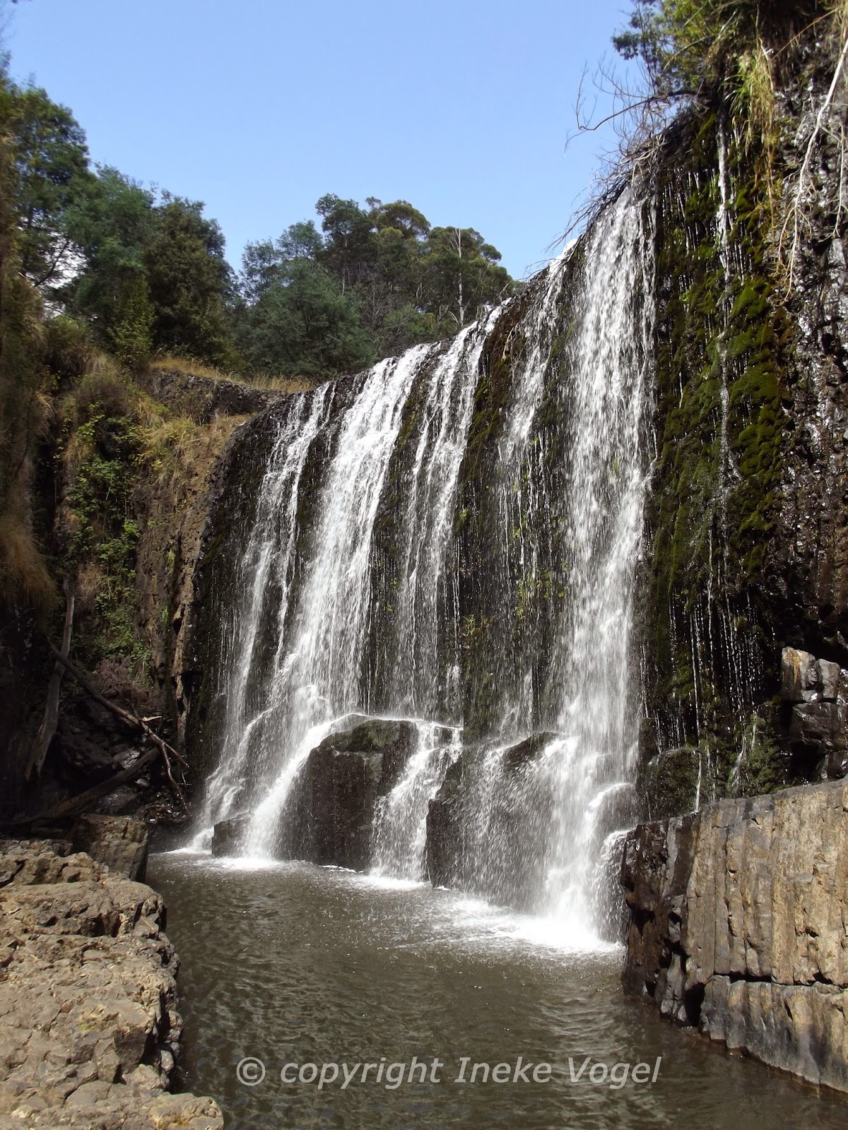
The Guide Falls is a stunning waterfall 19 km south of Burnie in North West Tasmania.
A beautiful falls which drops about 30 meters.

View from above:


Guide Falls


View from the base of the falls:


Guide Falls


Guide Falls

Guide Falls


Cascades at end of Waterfall on the way to the carpark:


Guide Falls


Approximate coordinates: -41.157935, 145.804056

Wednesday, 1 February 2012

Halls Falls - Tasmania

The Halls Falls is a relatively unknown waterfall in North East Tasmania.
An easy, hour walk gets you to this beautiful Falls.

Turn off the A3 near Pyengana onto Anchor Road. 
Approx 0.8 km up this road is the start of the Halls Falls walk.  


Halls Fall Tasmania


Top of the Falls:


Halls Falls


Base of the falls with beautiful rock pools:


Halls Falls


Halls Falls


Halls Falls


Approximate coordinates: -41.261081, 148.026134