McKenzie Falls is a waterfall located in Grampians National Park in Australia. The falls reaches heights of 20 to 25 meters and is 20 m wide.
The 167,219-hectare national park is situated between Stawell and Horsham on the Western Highway and Dunkeld on the Glenelg Highway, 260 kilometres (160 mi) west of Melbourne and 460 kilometres (290 mi) east of Adelaide.
In my opinion the best falls of the Grampians, flows all year round.
They just opened a lot of the walks again, after the devastating January 2014 bush fires.
MacKenzie Falls Walk to base of Falls
Distance: 2km return
Time: 1 hour 20 minutes
Elevation change: 110 metres
Grade: medium/steep
Start: MacKenzie Falls Carpark
To the base of MacKenzie Falls, walk along the signposted track past Cranages Lookout. Take care as this walk has many steps and is steep, slippery and strenuous in sections. Return the same route.
Still a lot of burnt trees and scrub form the 2014 Bush fires.
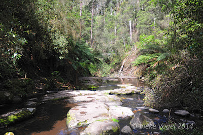
View of the MacKenzie river
On our way down to the base, this is a quite steep descend.
View from the base of the falls, you see all the stairs?
Cross the MacKenzie river for the best view of the falls.
These photos are taken by my husband with a special filter:
My photo's without filter:
The Mackenzie Falls has it's name from the Mackenzie river, which is named after Captain Mackenzie in 1836.
Approximate coordinates: -37.110824, 142.408777


.jpg)
.jpg)


