Friday, 17 October 2014

Straw Falls - Victoria

Straw Falls are a 15m cascade on the Erskine River
and are a further 400m downstreams of Erskine Falls.

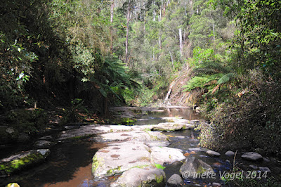
This is not an easy walk, you have to jump rocks and climb over trees, it also can be very slippery.
Do not attempt this in high water.


On the map below, left top you'll see the falls.


Warning sign to Straw Falls, Victoria

Warning signs to Straw Falls, Victoria


It is a beautiful walk, but you'll have to be careful.
The Falls were a bit dry, it was October when I took these.


The path to the Straw falls from Erskine Falls

Name sign for Straw Falls, Victoria
Straw Falls, Victoria

path near Straw Falls, Victoria


path near Straw Falls, Victoria


Approx. coordinates: S38 30.511 E143 54.654

Erskine Falls - Victoria

The Erskine falls are located in the Otway Ranges, Victoria.
Erskine Falls are at the end of Erskine Falls Road, 10km north west of Lorne. There is a viewing point above the falls and a walking track, steep in places, leads to the base of the falls.
The falls cascade over one of the highest drops (30 meters) in the Otways into the Erskine river.


Map of the area

The walk is easy, to the base of the falls is approx. 220 meters.

There is a viewing platform 80 meters from the car-park, but the view is quite obstructed:


view from upper Erskine Falls look-out


There is a path to the base of the falls,
down to the Erskine river, 200 meters one way.
It is easy going down but steep going up.

It is a good walk, well constructed.


Follow the river downstream and you will go to the Straw Falls.


Back to the car park are a lot of steps back up:


Erskine Falls steps


Approximate coordinates: -38.505392,143.911175

Wednesday, 15 October 2014

Silverband Falls - Victoria

The Silverband Falls are waterfalls located in the Grampians National Park, in western Victoria.
Fed by Dairy Creek, the falls are characterized by a narrow band of water that tumbles over a small rock face and then disappears into a rocky base. The creek re-emerges some 50 metres west of the falls.


Start from the car park and it is an easy 800 meter walk through shady forest.
You have to cross a small rock crossing. It is a 40 minutes return walk.


The falls are quite small, but are very beautiful, and so are it's surroundings.
We were the only visitors that day and is was so nice and serene.


The name Silverband comes from the look of the falls in the distance, it looks like a silver vertical band, specially in bright sunlight.


The creek next to the foot path, on the way back to the car park.


Approximate coordinates: -37.198537, 142.528439

Broken Falls - Victoria

The Broken falls are on the track to MacKenzie falls, only a 200 meter detour.
I don't know the height of this falls, there is no mention of it anywhere.


It is a short, 500 meter easy stroll to a viewing platform overlooking Broken Falls.

Broken Falls Lookout provides a sweeping view of the MacKenzie River as it cascades over Broken Falls. The cantilevered lookout sits on the edge of the gorge. The lookout is accessed via a short, sealed walking track from MacKenzie Falls Carpark. 

The initial section is steep, but the track and lookout are suitable for wheelchairs.


Still a lot of damage after the huge January 2014
Bush fires


Broken falls gets it's name from  the fragmented look of the falls.
It looks broken.


Approximate coordinates: -37.110336, 142.412607

MacKenzie Falls - Victoria


McKenzie Falls is a waterfall located in Grampians National Park in Australia. The falls reaches heights of 20 to 25 meters and is 20 m wide.
The 167,219-hectare national park is situated between Stawell and Horsham on the Western Highway and Dunkeld on the Glenelg Highway, 260 kilometres (160 mi) west of Melbourne and 460 kilometres (290 mi) east of Adelaide.


In my opinion the best falls of the Grampians, flows all year round.
They just opened a lot of the walks again, after the devastating January 2014 bush fires.


MacKenzie Falls Walk to base of Falls

Distance: 2km return
Time: 1 hour 20 minutes
Elevation change: 110 metres
Grade: medium/steep
Start: MacKenzie Falls Carpark
To the base of MacKenzie Falls, walk along the signposted track past Cranages Lookout. Take care as this walk has many steps and is steep, slippery and strenuous in sections. Return the same route.


Still a lot of burnt trees and scrub form the 2014 Bush fires.


View of the MacKenzie river


On our way down to the base, this is a quite steep descend.


View from the base of the falls, you see all the stairs?


Cross the MacKenzie river for the best view of the falls.


These photos are taken by my husband with a special filter:


My photo's without filter: 


The Mackenzie Falls has it's name from the Mackenzie river, which is named after Captain Mackenzie in 1836.

Approximate coordinates: -37.110824, 142.408777